Techniques
MASW (Multi Channel Analysis of Surface Waves)
PARSAN is stretching its wings to provide services for carrying out MASW for engineering projects. MASW is one of the seismic survey methods used for evaluating elastic conditions of ground. Surface waves are generated in all seismic surveys, have the strongest energy and its propagation velocities are mainly determined by the medium’s shear wave velocity. MASW method makes use of dispersion property of surface waves.
Engineering value
Shear-wave velocity in the upper 30 m
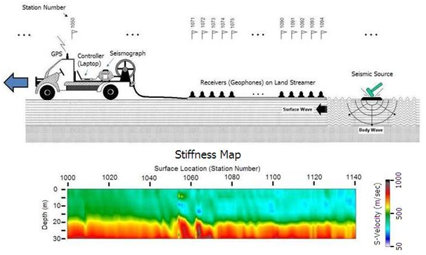
Through MASW survey, shear wave velocity (Vs) is provided for upper 30m depth of strata in soil as well as rock. VS is the best indicator of shear modulus and is closely related to Young’s modulus. In most cases, VS is directly linked to material’s strength and is a critical engineering property.
Methodology
Dispersion of surface waves
MASW method makes use of dispersion property of surface waves to evaluate the elastic conditions and shear-wave velocity of the ground.
Active survey Highlights
Field survey characteristics
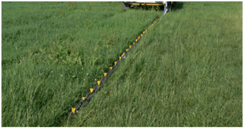
- The data are collected through an array of geophones on surface without any need of boreholes
- Geophones of 4.5 Hz frequency are used
- 10kg hammer is used as active source
- Tests are carried out with 2D profile
- The maximum depth of investigation (Z max ) is usually 10-30 m
- Overall topographic variation within an entire survey line should not be critical as Surface waves are best generated over a ‘flat’ ground.
Applications
Typical engineering uses
- VS 30 is calculated for Seismic Site Classification and Seismic Microzonation
- Mostly used within geotechnical applications, ex. all infrastructure projects which require engineering properties of material in top 30m strata
- Soil bedrock mapping delineating interface of soil and bedrock
- Variation of VS within soil/ rock
- Locating loose soil area and soft clay areas.
- Mapping voids