Why Parsan
Innovative Solutions for Subsurface Challenges
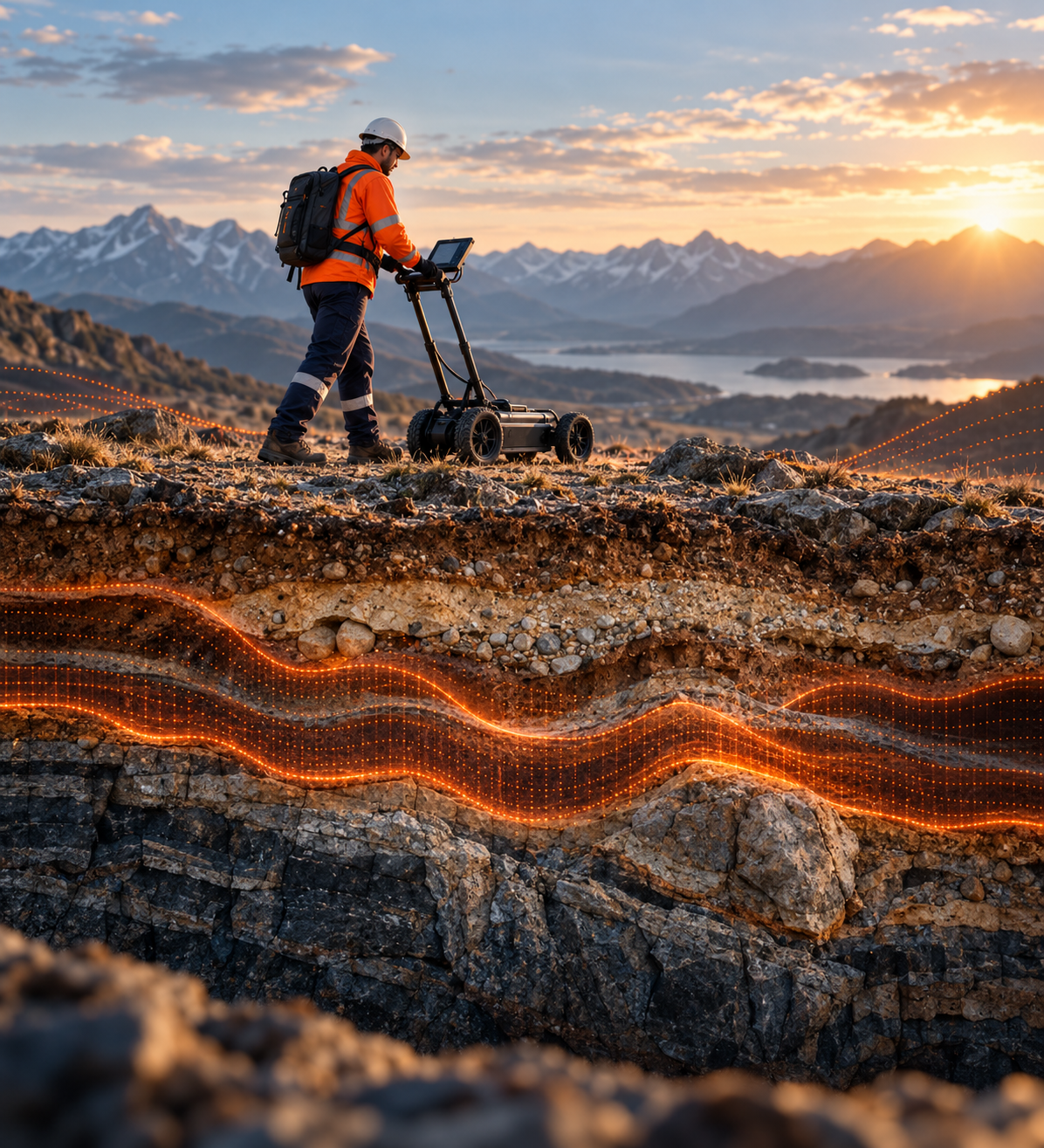
When critical decisions depend on what you cannot see, you need more than data. You need understanding.
For over two decades, PARSAN has helped organisations investigate the unseen, uncovering the conditions, risks and uncertainties beneath the surface that can shape critical engineering and infrastructure decisions.
Advanced Technology
We bring together advanced geophysical technologies, integrated investigation and deep technical expertise to solve complex subsurface challenges.
Integrated Expertise
The right answer often lies in bringing together multiple techniques, perspectives and decades of experience to see the complete picture.
Confident Decisions
We reduce subsurface uncertainty, helping clients make confident decisions and minimize risk.
“
We don’t just investigate what lies beneath.
We help you decide what comes next.
Our Journey
Key Milestones
Marking two decades of innovation, expertise, and groundbreaking achievements in applied geophysics
2001
Founded in New Delhi
ISO-certified private geophysics practice established by Dr. Sanjay Rana with a vision to bring innovation to subsurface investigations.
2002
Afghanistan Operations
First international assignment — deep aquifer mapping in post-conflict terrain. A bold step into global markets.
2008
ReMi Introduced to India
First in India to deploy Refraction Microtremor technology — superior to MASW in urban noise environments.
2012
Passive Seismic Tomography
Launched Passive Seismic Tomography in partnership with Seismotech Geophysical Solutions, Greece — revolutionary technology for India.
2024
Global Expansion
Branch offices operational in Singapore, Kingdom of Saudi Arabia, and Kingdom of Bahrain. PARSAN goes truly global.
Latest Videos Just for You
Stories in Motion
Dam Presentation
PARSAN in Motion
Global Presence
Operating Across 4 Key Regions

India
Headquarters
707, Eros Apartments, 56 Nehru Place, New Delhi 110019.
.png)
Saudi Arabia
Branch Office
P.O. Box 2319, Prince Fawaz Street & 7th Street, Al Khobar, KSA 31952

Bahrain
Branch Office
Al Baraka Building, Flat 301, Road 1802, Block 318, Al Hoora, Manama
Singapore
Branch Office
60 Woodlands Drive 16 #01-22 La Casa, Singapore 737896
Track Record
Successful Projects in 12 Countries
South Asia · Gulf · Africa
Track Record
Selected Projects
Every project below was a decision someone had to get right — a foundation design, a tunnel advance, a dam's safety margin — not just a survey delivered on time.
Challenge
Siting a mega hydroelectric scheme's dam and powerhouse in seismically active, geologically complex Himalayan terrain.
Risk Factor
Unmapped fault zones or weak rock bands beneath critical structures could force a costly mid-construction redesign.
Our Intervention
Integrated seismic refraction, resistivity imaging and borehole seismic tomography across the dam axis and intake structures.
Outcome
Critical structures were sited on confirmed competent ground ahead of detailed design, reducing reliance on drilling alone.
Challenge
Nuclear-grade site characterisation, where subsurface uncertainty is not an acceptable starting condition.
Risk Factor
An unidentified shear zone or liquefiable layer beneath a safety-critical structure risks a regulatory hold or late redesign.
Our Intervention
Geotechnical geophysics integrating seismic and resistivity methods to the resolution nuclear siting studies require.
Outcome
Site characterisation supported engineering sign-off to proceed with confidence on safety-critical foundation design.
Challenge
Dense, live urban corridors where unknown buried utilities are the single biggest source of construction delay.
Risk Factor
An undetected utility along the tunnel or station footprint risks a service strike, a stoppage, and a claim from the utility owner.
Our Intervention
Subsurface utility engineering and urban subsurface mapping along the alignment, flagging conflicts before excavation reached them.
Outcome
Utility conflicts were resolved ahead of construction, avoiding the stoppages and claims undetected utilities typically cause.
Challenge
Assessing the internal condition of one of India's most scrutinised ageing dams without invasive drilling into a sensitive structure.
Risk Factor
Internal erosion or an active seepage path can advance silently for years before surfacing as a structural emergency.
Our Intervention
Integrated non-destructive testing — resistivity, GPR and seismic methods — to trace leakage pathways and assess internal condition.
Outcome
Gave the dam authority a non-invasive, evidence-based basis to prioritise monitoring and remediation.
Challenge
Locating viable groundwater in hostile, conflict-affected terrain with no existing subsurface data.
Risk Factor
Drilling blind in structurally complex terrain risked a dry or low-yield well at a cost and security risk not worth repeating.
Our Intervention
A multi-year deep aquifer mapping programme using methods suited to rapid, low-footprint deployment in active-conflict conditions.
Outcome
Identified viable aquifer targets, materially improving borehole success rates where a failed well was not an affordable repeat.
Challenge
A nationwide telecom rollout where a utility strike during trenching stalls every crew behind it on the same corridor.
Risk Factor
Unmapped utilities along proposed cable routes risk strikes and rework multiplied across hundreds of corridor segments at once.
Our Intervention
Utility detection and corridor mapping at national scale, standardising a repeatable survey-to-clearance process for the rollout.
Outcome
Corridor segments were cleared ahead of trenching at the pace the rollout schedule required.
Challenge
Prioritising where to drill for strategic mineral reserves against a finite national exploration budget.
Risk Factor
Without subsurface targeting, exploration drilling is effectively speculative spending against that budget.
Our Intervention
Mineral exploration geophysics to identify and rank subsurface anomalies ahead of any drilling commitment.
Outcome
Sharper-targeted drilling programmes against a finite exploration budget.
Frequently Asked Questions
Have Questions? We've Got Answers
Geophysics is a non-destructive and non-invasive Earth Science that uses the latest science and technology in instrumentation, data acquisition and advanced computer modeling.
No. Geophysics is used to quickly scan large areas and prepare subsurface property maps. These maps delineate various subsurface features like faults, fractures, shear zones, overburden thickness, bedrock topography, etc. and provide detailed insight into the geological setting of the area. Drilling can then be performed selectively on the 'anomalies'. Geophysics therefore reduces random drilling to a large extent, saving on cost and time.
The best time to use geophysics is in the early stage of a project, followed by investigation using traditional methods.
All geophysical investigation requirements are unique. It is essential to carefully choose a set of geophysical tools based on geological conditions and the aim of the investigation. A well-equipped geophysical company is better placed to provide the most comprehensive and optimal solution for a geophysical investigation.
Parsan delivers contracting and consulting services in applied near-surface geophysics across sectors like infrastructure, mining, civil engineering, hydrology, and environment. Using various geophysical techniques i.e. seismic, electrical, electromagnetic, magnetic, gravity, etc., we tailor integrated solutions for site characterization, subsurface mapping, structural health audit, etc.
For dam safety projects, PARSAN utilizes a range of non-invasive geophysical techniques to detect seepage, internal erosion, voids, and structural anomalies within earthen, masonry, and concrete dams. Key methods include Electrical Resistivity Imaging (ERI) to trace saturation zones and seepage paths, Ground Penetrating Radar (GPR) for identifying cracks and voids in concrete and masonry structures, and Streaming Potential surveys to pinpoint active seepage flows. Seismic Refraction is used to assess foundation integrity and internal layering, while ReMi or MASW provides shear-wave velocity profiles for dynamic stability analysis. Seismic Tomography is used to obtain a high resolution P-wave velocity distribution (density) inside the dam body.
For infrastructure projects, PARSAN employs a wide array of advanced geophysical techniques to assess subsurface conditions critical for design, construction, and long-term performance. These include Seismic Refraction and ReMi for mapping bedrock depth and evaluating soil stiffness, Electrical Resistivity Imaging (ERI) for detecting groundwater, cavities, and weak zones, and Ground Penetrating Radar (GPR) for locating buried utilities and assessing pavement layers. Crosshole and Downhole Seismic surveys are used to determine dynamic soil properties, while Seismic Tomography helps image complex subsurface features around tunnels and foundations. Other methods like Induced Polarization (IP), Electromagnetic (EM) surveys, and Gravity & Magnetic techniques support geological mapping and hazard identification. Subsurface Utility Engineering (SUE) and geodetic surveys using GPS and Total Station are also integral to infrastructure planning.
In addition to India, Parsan has offices in Singapore, Bahrain, and Saudi Arabia, and has conducted projects in Afghanistan, Oman, Kuwait, Nepal, Bhutan, Bangladesh, Egypt, and Sudan.
Yes, Parsan Overseas is certified under ISO 9001-2015, reflecting its commitment to quality systems across all technical and consulting services.
Because no single geophysical method solves all subsurface issues, Parsan integrates multiple techniques to obtain holistic data — accelerating project timelines, reducing drilling costs, and minimizing risks.
Parsan provides leak detection via zone flow measurement, acoustic correlation, geophones, and GPR imaging, combined with GIS-based visualization to efficiently locate even hidden leaks.
Parsan owns the largest range of near-surface geophysical equipment in the Indian private sector and is staffed by experienced geophysicists and engineers who customize techniques based on site needs.
Projects range from hydroelectric dams, nuclear & thermal power plants, and metro & highway projects, to urban utilities, mineral exploration, and aquifer mapping in challenging terrains.
With portable digital acquisition systems, Parsan can perform rapid, onsite surveys over large areas, enabling fast subsurface evaluation without delays.
Parsan has collaborated with major infrastructure clients including L&T, AFCONS, NHIDCL, Tata Projects, as well as institutions like ONGC, OIL, and government bodies across India and the Middle East for high-profile infrastructure geophysical studies.
Project enquiry
Send us the brief
Share a few details and we will get back to you shortly.